
Traversing the Island
- Sophia Laporte
- 14 mai 2021
- 2 min de lecture
At the beginning of February, Christophe (district manager) and I accompanied Luc (natural reserve agent responsible for introduced mammals) to Le Pignon to replace his cat traps. We crossed the island along the summits, following the Entrecasteaux transit, passing through the Caldera and the highest peak on the island: the Dives.
Along this journey, we saw several plant species, endemic (= present in Amsterdam only), indigenous (= present in Amsterdam, but not only) and introduced (= often undesirable, imported with the arrival of first missions on the island).
To not to get lost on the way, here is a map of the island with the main sites:

It all started from the base where we took the tractor path to Dumas craters, east of the base. From there, in the ferns and grasses, a path appears; formed by multiple crossings over the years. We started to climb the island (700m elevation) and passed several small craters. The weather was so beautiful, the view was clear (not like the last time I took this transit, when I couldn't see much at all)!


At 300m altitude, we arrived in the large patches of Gleichenia, a native fern of the island. They are a beautiful florescent green color.


You can see the east coast of the island, and the ocean as far as the eye can see.


There are all kinds of native plant species:


Lycopods,

Gleichenia which begin to fade among mosses and other ferns,

and deer-tongue ferns (Elaphoglossum).
The hike continued, and we arrived at the first mosses, each more colorful than the next.


We were approaching Olympe, the "false summit" that we can see from the base.

After another hour, the difference in the elevation of the slopes became less and we arrived at the Caldera.


This landscape is impressive. A caldera is a large circular, or elliptical depression located in the heart of certain large volcanic edifices. It is the result of an eruption that empties the underlying magma chamber.
We walked along the caldera ridge, then climbed to the highest peak of the island: the Dives, summit at 881m altitude. Up there, a 360 ° view awaits us!

And yes, we are indeed on an island, surrounded by ocean as far as the eye can see!
We feel very small.


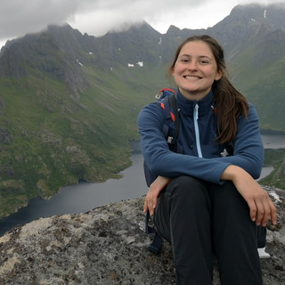
We found ourselves a fabulous picnic-nap spot ... wonderfu!

There are beautiful endemic plant species such as plantain.

Then it was off to the Pignon. We descended the Dives to join the track, which is marked with duckboards on several portions to avoid trampling the fragile vegetation.


The rocky summit you see on the right is Mount Fernand (731m altitude), which borders the Tourbières plateau.

Here we are at the Pignon, with a clear view, the weather was so beautiful. You can see the point of Entrecasteaux with the hut and the yellow-billed albatross colonies.


There were also many Sooty (dark) albatrosses and even a few Amsterdam albatrosses.

The water was very clear


The Sooty albatross often fly in pairs


We saw lots of Skuas flying around the plateau.

We stayed there for quite some time, admiring the view and all the birds flying. Then, we headed back to base along the same track.
In all, we took about 7 hours to cross the island over the summits, and on such a beautiful day, it was a real pleasure!


Commentaires